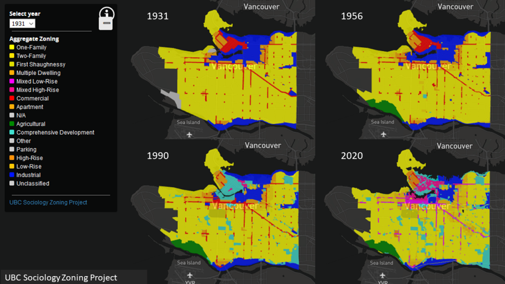
Interactive Historical Zoning Maps are now available and in progress through the project. This list will be updated. Zoning data are obtained from archival historical maps checked against bylaws and other archival materials. Source information available soon.
| MAP | LEVEL | DATE |
| City of Vancouver Zoning Maps, 1931-2020 | Aggregate | November 2020 |
| TBD |
Allowed Use Categories in Historical Zoning Maps are drawn from the maps themselves, with 2020 categories harmonized and carried over from our contemporary map series. More documentation coming soon!